The best Tokyo base isn’t about choosing East or West; it’s about mastering the city’s operational systems for maximum efficiency and experience.
- Analyze Tokyo as three core infrastructures: transit flow, vertical space, and subterranean networks.
- Cluster your daily activities along single train lines to save hours of transfer time and navigation stress.
Recommendation: Select your accommodation based on its proximity to a Yamanote Line station and its ability to facilitate a “reverse commute,” moving against the primary flow of morning rush hour.
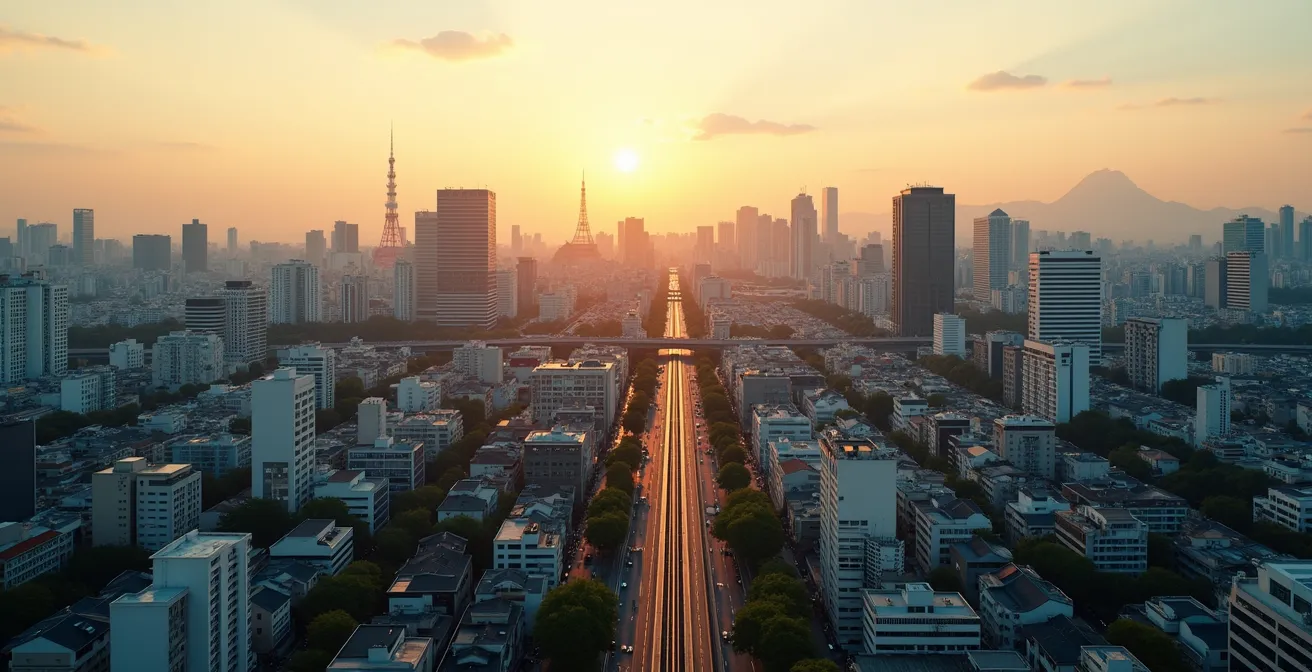
The sheer scale of Tokyo can feel paralyzing. Staring at its sprawling subway map, the first-time visitor faces a critical decision that will define their entire trip: where to establish a base of operations? The city presents itself as a paradox of neon-drenched futurism and serene, ancient traditions. This duality is most apparent in the common debate between basing oneself in the modern, chaotic West (like Shinjuku or Shibuya) or the historic, calmer East (like Asakusa or Ueno).
Conventional wisdom offers a simple answer: choose the West for nightlife and shopping, the East for culture and a slower pace. While not incorrect, this advice barely scratches the surface. It treats Tokyo as a mere collection of attractions rather than what it truly is: a complex, living urban system. To conquer its overwhelming scale, you must think not as a tourist, but as a city planner. The key to an optimized Tokyo experience lies not in the personality of a district, but in mastering the three core infrastructures that govern life within it: the relentless flow of its transit, the strategic use of its verticality, and the hidden convenience of its subterranean networks.
This guide will deconstruct these systems, providing a strategic framework to help you select an operational base. We will analyze the critical arteries of the JR and Metro lines, explore how to leverage commuter patterns to your advantage, and reveal how to navigate the city’s multi-layered environment. By the end, you will be equipped to make a decision based on logistical superiority, not just aesthetic preference, ensuring your time in Tokyo is spent exploring, not commuting.
To help you navigate this strategic decision, this article breaks down the essential systems of the city. The following sections will guide you through the core components of Tokyo’s urban fabric, from its sprawling train network to its hidden viewpoints.
Summary: A Planner’s Blueprint to Tokyo
- Metro or JR: How to Navigate the Spider Web of Tokyo Trains?
- 7 AM to 9 AM: Why You Must Avoid Tokyo Trains During Commute Hours?
- Skytree or Gov Building: Which Tokyo View Is Best (and Free)?
- Depachika and Subways: How to Walk Through Tokyo Without Going Outside?
- Asakusa or Shinjuku: Which District Matches Your Personality?
- Why Adding Suica to Apple Wallet Is Better Than a Physical Card?
- How to Group Tokyo Neighborhoods to Save 3 Hours Daily?
- Crossing the Scramble: How to Get the Perfect Shot Without Dying?
Metro or JR: How to Navigate the Spider Web of Tokyo Trains?
The first rule of Tokyo urbanism is that not all train lines are created equal. The network is a complex web operated by multiple companies, but for the strategic traveler, two systems matter most: the Japan Rail (JR) lines, particularly the loop of the Yamanote Line, and the sprawling Tokyo Metro subway. The Yamanote Line acts as the city’s central artery, connecting nearly all major urban hubs like Shinjuku, Shibuya, Tokyo Station, and Ueno. Basing yourself near a Yamanote station is the single most effective decision for maximizing flexibility.
While the Metro system is more granular, allowing for precise point-to-point travel, it often requires more transfers and deeper navigation through cavernous stations. A planner’s approach prioritizes minimizing these transfers. The goal is to establish a “two-transfer rule”: your base should be within walking distance of a primary station (ideally on the Yamanote) and require no more than two train changes to reach 80% of your planned destinations. The complexity of this system is a direct response to the sheer volume of passengers; a 2024 government survey revealed an average train congestion rate of 136% during peak times, making an efficient route a non-negotiable part of your daily strategy.
Think of the JR Yamanote as your highway and the Metro lines as your local roads. Use the highway for long-haul jumps between major zones and switch to local roads only for the final leg of your journey. This approach not only saves time but significantly reduces the cognitive load of navigating a system designed for millions of daily commuters. Before booking any accommodation, map your key points of interest and trace your potential daily commute—the results will often reveal a clear logistical winner.
7 AM to 9 AM: Why You Must Avoid Tokyo Trains During Commute Hours?
The morning rush hour in Tokyo, from approximately 7:00 AM to 9:00 AM, is not merely an inconvenience; it is an immovable force of nature. During this window, the city’s transit system operates under immense pressure. While the average congestion is high, specific lines become almost impassable for a casual traveler. For instance, data shows the Toei Nippori-toneri Liner can reach a 171% congestion rate, a figure that translates to being physically compressed with no personal space. Attempting to board a train with luggage or navigate a multi-transfer route during these hours is a recipe for stress and exhaustion.
The strategic solution is not to endure it, but to design your day around it. This is where the “Reverse Commute” strategy becomes a powerful tool. Instead of joining the wave of commuters heading into central business districts, you travel against it. By planning morning activities in peripheral areas, you can enjoy a surprisingly comfortable journey. This approach requires you to embrace a different rhythm for your day.
Case Study: The Reverse Commute Strategy
Travel experts have championed the “Reverse Commute” for visitors staying in central hubs like Shinjuku or Shibuya. By scheduling a morning trip to a destination like the Ghibli Museum in Mitaka (West) or Tokyo DisneySea (East), travelers move against the primary flow of office workers. The result is a relaxed train ride even during peak hours, transforming a stressful daily event into a seamless part of the experience. This strategy turns the city’s biggest logistical challenge into a distinct advantage.
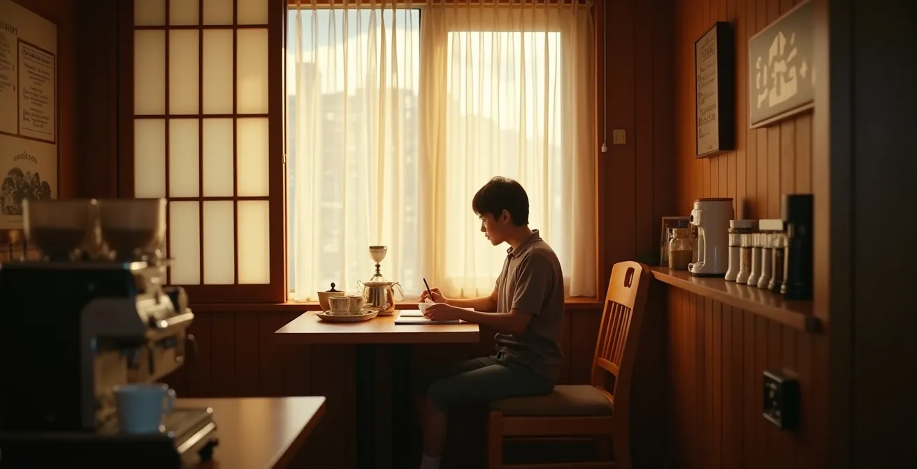
Rather than fighting the crowds, use this time to enjoy a quiet morning ritual. Tokyo is famous for its kissaten, traditional coffee shops offering “morning sets” of thick toast, coffee, and eggs. This is the planner’s alternative: let the city’s workforce flow past while you calmly map out your day’s movements from a peaceful vantage point, ready to enter the transit system just as it begins to breathe again.
Skytree or Gov Building: Which Tokyo View Is Best (and Free)?
Tokyo’s verticality is a key component of its urban fabric, and no trip is complete without taking in the view from above. The two most famous observation decks represent the city’s core East/West dichotomy: the Tokyo Skytree in the East and the Tokyo Metropolitan Government Building in Shinjuku, the West. The choice between them is not about height, but about strategic intent. What do you want to see? The Government Building, which is entirely free to access, offers a stunning westward panorama. From its 202-meter-high observation deck, you look out over the dense cluster of Shinjuku’s skyscrapers toward the distant silhouette of Mount Fuji on a clear day.
The Tokyo Skytree, on the other hand, provides a commanding eastward view from its platforms at 350 and 450 meters. For a fee, you can watch the city sprawl out towards the bay, with the iconic Tokyo Tower looking almost miniature in the distance. The experience is different: the Government Building situates you within the forest of skyscrapers, while the Skytree has you observing the entire ecosystem from afar. As travel expert Chris Rowthorn notes, the Skytree offers a view *of* the Shinjuku skyline, while the Government Building places you *inside* it.
For the budget-conscious planner, the Metropolitan Government Building is the clear winner, offering a world-class view with zero cost and often shorter queues. For photographers, the decision depends on the subject. To capture the iconic shot of the sun setting behind Mount Fuji and the Shinjuku skyline, the Skytree is your vantage point. To capture the scale of the eastern metropolis stretching to the horizon, the Government Building is superior. Other paid options like Shibuya Sky offer a 360-degree open-air experience, but for a simple, effective, and free analysis of the cityscape, the Government Building is an unbeatable strategic asset.
Depachika and Subways: How to Walk Through Tokyo Without Going Outside?
A master planner knows that a city exists on multiple levels. In Tokyo, the most overlooked of these is the vast, climate-controlled world that exists underground. The city’s subterranean networks, connecting major subway and train stations, are far more than simple transit corridors. They are a parallel city, offering a strategic way to navigate large distances, shop, and dine, all while being completely sheltered from scorching summer heat, winter cold, or sudden downpours. Understanding and utilizing this network is a hallmark of an advanced urban explorer.
The most impressive example of this is the labyrinth beneath Tokyo Station. This network is a destination in itself, allowing you to walk for hours without ever surfacing. It connects the Marunouchi and Yaesu sides of the station, which are a significant distance apart at ground level. This underground city is home to “Character Street,” a haven for anime and character goods; “Ramen Street,” featuring eight of the city’s top ramen shops; and multiple depachika—the sprawling, gourmet food halls located in the basements of department stores.
These depachika are a universe of their own, offering everything from exquisite bento boxes and artisanal sweets to free samples of premium sake and seasonal fruits. For the planner, this subterranean system serves a dual purpose. It is a highly efficient, weatherproof navigation tool. It is also an immersive cultural and culinary experience. Instead of walking 15 minutes in the rain from your train to a restaurant, you can navigate the entire journey underground, stopping for a gourmet meal at a depachika along the way. During peak “time sales” after 7 PM, you can even acquire premium meals for 30-50% off, a classic life-hack for locals.
Asakusa or Shinjuku: Which District Matches Your Personality?
With an understanding of Tokyo’s core systems, the final decision of East vs. West becomes a clear-cut choice of operational style. Your base is no longer just a “neighborhood”; it is the central hub from which your daily strategies will launch. Do you prefer a quieter, more traditional hub that winds down early, or a vibrant, 24/7 core that serves as a launchpad for nightlife and modern entertainment?
The East, represented by Asakusa and Ueno, offers a more traditional and relaxed atmosphere. It’s a land of temples, museums, and local markets. Mornings here are peaceful, perfect for an early stroll through Senso-ji Temple grounds before the crowds arrive. This tranquility comes with a significant logistical benefit: data from real estate platforms shows that Eastern Tokyo districts can offer 20-30% lower accommodation costs compared to their western counterparts. The trade-off is that the area becomes very quiet at night, with last trains running earlier.
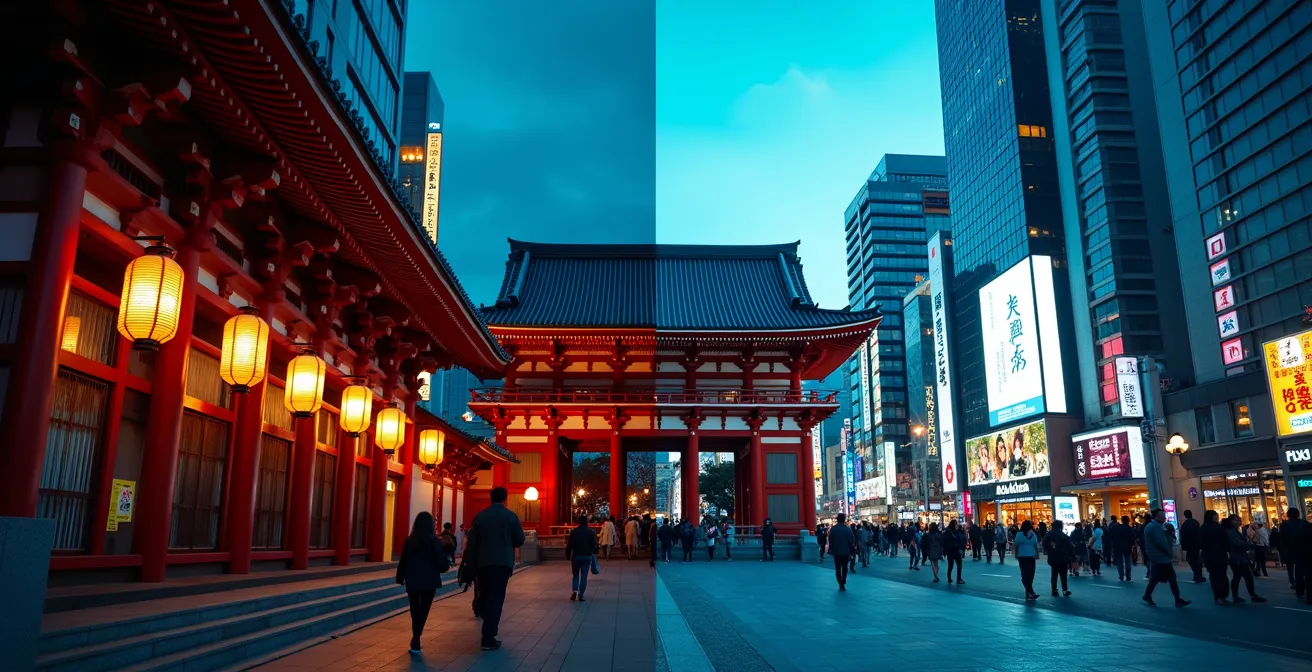
The West, anchored by Shinjuku and Shibuya, is the city’s modern heart. It is a dazzling, high-energy environment of neon lights, endless shopping, and dense crowds. It offers unparalleled access to nightlife and direct train lines for day trips towards Mount Fuji. However, this vibrancy comes at a premium price and with constant high foot traffic. Your morning experience will be defined by the business rush, and your nights by the energy of a city that never truly sleeps.
This comparison from a travel forum highlights the key differences for a planner’s decision.
| Factor | East Tokyo (Asakusa/Ueno) | West Tokyo (Shinjuku/Shibuya) |
|---|---|---|
| Atmosphere | Traditional, quieter, temple districts | Modern, vibrant, neon-lit entertainment |
| Hotel Prices | Generally lower | Premium pricing, especially Shibuya |
| Tourist Density | Concentrated around temples | Constant high foot traffic |
| Last Train Times | Earlier (around 11:30 PM) | Later (past midnight) |
| Morning Experience | Peaceful temple grounds, local markets | Business rush, crowded stations |
| Best For | Cultural immersion, families, budget travelers | Nightlife, shopping, first-timers |
Why Adding Suica to Apple Wallet Is Better Than a Physical Card?
In a city as reliant on transit as Tokyo, seamless payment is a cornerstone of efficient movement. While the physical Suica card has been a staple for years, integrating it into your Apple Wallet or Google Pay represents a significant upgrade in operational efficiency. A digital Suica turns your smartphone into an all-in-one tool for urban navigation. You can tap through ticket gates without fumbling for a card, and more importantly, you can recharge it instantly with a credit card, bypassing the need to find a machine and use cash.
This digital integration extends far beyond the train system. The Suica is a near-universal cashless payment method in Tokyo, accepted at convenience stores (konbini), vending machines, coin lockers, and a vast number of shops and restaurants. Having it on your phone streamlines countless small transactions, saving time and mental energy throughout the day. It allows you to move through the city with the fluid, frictionless ease of a local.
However, relying on a digital system introduces a critical point of failure: a dead phone battery. A smart planner always has a contingency for this. The “Express Mode” on iPhones provides a reserve power for several hours after the device shuts down, but this is a limited failsafe. A robust backup plan is not just recommended; it is essential for maintaining operational independence.
Your Action Plan: The Dead Battery Backup Strategy
- Cash Reserve: Always carry ¥2,000-¥3,000 in cash. This is enough to buy an emergency paper ticket to get you back to your accommodation from almost anywhere in the city.
- Power Source: Know that every convenience store sells portable power banks (¥1,000-¥2,000), providing an immediate lifeline if you’re running low.
- Machine Locations: Mentally note the locations of ticket and recharge machines at your home station and other key hubs.
- Offline Navigation: Download an offline map of the Tokyo subway system. This ensures you can plan a route even without a data connection or power.
- Physical Backup: For ultimate security, consider carrying a secondary, physical PASMO or Suica card with a small balance as a final fallback.
How to Group Tokyo Neighborhoods to Save 3 Hours Daily?
The most common mistake visitors make in Tokyo is crisscrossing the city inefficiently, wasting hours on redundant train journeys. A strategic planner treats the city map like a chessboard, grouping movements into logical, geographically-cohesive clusters. The goal is to spend a full day or a half-day exploring a cluster of adjacent neighborhoods, minimizing travel time and maximizing exploration time. This “single-line strategy” is a game-changer, potentially saving up to three hours per day.
Case Study: The “Ginza Line Day” Strategy
A classic example of this strategy involves dedicating a day to the Ginza subway line. A traveler can start their morning in Asakusa (exploring Senso-ji Temple), take the Ginza line a few stops to Ueno (visiting its world-class museums and park), continue to Ginza for upscale shopping in the afternoon, and finally end the day in Shibuya for dinner and nightlife, which is the line’s terminus. By staying on a single, direct line, the traveler eliminates all transfer time, avoids the stress of navigating complex interchange stations, and can often use a simple and cost-effective day pass.
This clustering principle can be applied across the city. Harajuku, Omotesando, and Shibuya form a natural “Modern West” cluster that is almost entirely walkable. Akihabara (electronics and anime), Kanda (old bookstores), and the Imperial Palace East Garden form a “Central Culture” cluster. By designing your itinerary around these logical groupings, you transform your visit from a chaotic series of disconnected points into a smooth, flowing journey through the city’s diverse landscapes.
To aid in this process, urban explorers can use pre-defined clusters as a starting point for their own custom itineraries, as shown in the popular sightseeing guide below.
| Cluster Name | Neighborhoods | Key Attractions | Time Needed | Best Transport |
|---|---|---|---|---|
| Modern West | Harajuku, Shibuya, Omotesando | Meiji Jingu, Takeshita St, Scramble | Full day | JR Yamanote/Walk |
| Traditional East | Asakusa, Ueno, Yanaka | Senso-ji, Museums, Old Tokyo | Full day | Ginza/Hibiya Lines |
| Pop Culture Corridor | Nakano, Shinjuku, Akihabara | Anime, Electronics, Otaku culture | Full day | JR Chuo Line |
| Upscale Central | Ginza, Marunouchi, Roppongi | Shopping, Imperial Palace, Art | 6-8 hours | Marunouchi/Hibiya |
Key takeaways
- Frame your decision as a logistical problem: your goal is to create the most efficient “operational base.”
- Leverage the “Reverse Commute” and “Single-Line” strategies to save hours and avoid the city’s infamous rush hour.
- Master the city’s hidden layers, using subterranean networks for weatherproof navigation and observation decks for strategic orientation.
Crossing the Scramble: How to Get the Perfect Shot Without Dying?
The Shibuya Scramble Crossing is the pulsing heart of modern Tokyo, a mesmerizing spectacle of organized chaos. Capturing its iconic energy is a rite of passage, but getting the perfect shot requires more than just pointing your camera. It requires a planner’s approach to finding the optimal vantage point, away from the crush of the crowd. Simply standing in the middle of the crossing is dangerous and yields a chaotic, ground-level photo. The best shots are always taken from an elevated position.
The most famous viewpoint is the Starbucks overlooking the crossing, but it is perpetually crowded, and getting a window seat is a matter of pure luck. A true strategist seeks out superior, lesser-known alternatives. These spots offer better views with fewer people, allowing you to take your time and compose the perfect shot. These include:
- Shibuya Sky Rooftop: The highest and most dramatic view, though it requires a paid ticket and booking in advance.
- Mag’s Park Rooftop: A free and often overlooked spot on the roof of the Magnet by Shibuya 109 building, offering a fantastic eye-level perspective.
- Hikarie Sky Lobby: Located on the 11th floor of the Hikarie building, this free lobby has wide windows and is far less crowded than Starbucks.
- Shibuya Excel Hotel Tokyu: The restaurant on the 25th floor offers a magnificent top-down view; ordering a drink grants you access to a prime window seat.
Beyond location, timing is everything. The most compelling photographs are taken during the “blue hour,” the 20-30 minute window just after sunset. During this time, the fading natural light is perfectly balanced with the bright neon of the billboards, creating a rich, vibrant image that captures the essence of Shibuya’s electric atmosphere. Arriving at your chosen vantage point before this window is critical. This micro-challenge encapsulates the essence of navigating Tokyo: success comes from strategic planning, not from plunging into the chaos.
By applying this architectural and planning mindset—from choosing your base to capturing a photograph—you transform your relationship with Tokyo. You are no longer just a visitor being moved by the city’s currents; you are a strategic operator, navigating its systems with purpose and efficiency.
Frequently Asked Questions about Choosing Your Tokyo Base
Why won’t my foreign credit card work for top-ups on my digital Suica?
Many non-Japanese issued credit and debit cards are blocked for direct in-app recharges due to security protocols. The most reliable solution is to top up your digital Suica using cash at any train station ticket machine or at a 7-Eleven ATM. These machines are equipped to handle digital Suica recharges seamlessly.
What happens if my phone dies with a digital Suica?
Modern iPhones have an “Express Mode with power reserve” feature. This allows you to use your digital Suica for transit for up to five hours after the phone’s battery has died and the device has shut down. However, this is a limited failsafe and should not be relied upon as a primary strategy.
Can I use Suica for more than just trains?
Absolutely. The Suica is a comprehensive cashless payment system. It is widely accepted at all major convenience stores (konbini), on city buses, in many taxis, at countless vending machines, for coin lockers, and even in a large number of restaurants and shops. It effectively functions as a debit card for small daily expenses.